AvMap EKP-V Navigator

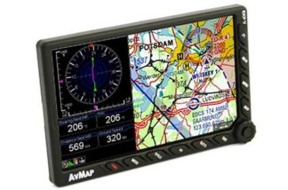
AvMap’s EKP-V Navigator is a slim and light, yet very powerful moving map GPS with 7” display, incorporating airport diagrmas and appraoch plates for Europe. The EKP-V Navigator is both a portable device and panel-mount solution, thanks to the smart cockpit docking station.

£1,380.00 (£1,150.00 ex. VAT)

In stock

Order before 14:00 for same day dispatch

Compare

Product code: AVMAPEKPV

SKU: AVMAPEKPV Category:

Description

AvMap’s EKP-V Navigator is a slim and light, yet very powerful moving map GPS with 7” display, incorporating airport diagrmas and appraoch plates for Europe. The EKP-V Navigator is both a portable device and panel-mount solution, thanks to the smart cockpit docking station.

Advanced Connectivity

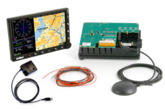
When used with the optional Docking Station (not included in the box),  EKP V can connect to several on-board devices at the same time (autopilot, weather, CAS,  video camera, AvMap A2 ADAHRS etc.) so that the large 7” LCD becomes a true multifunctional display and flight information system

Fully Customizable

Easily change the layout choosing what to see and where to display it: maps, TAWS, weather (optional), vertical profile on map, nav data, HSI, ADAHRS (optional). Set different profiles for different aircraft with different settings for TAWS, selective display and even different hard keys configurations.

User Friendly

The new practical keyboard includes a configurable key, a progressive joystick and a smart wheel selector. Ease of use is ensured by the new graphic interface and the full qwerty virtual keyboard.
Specification

Specification

Hardware

Dimensions 4.3” x 6.8” x 0.8”
Weight 14.1 Oz
Display 7” (16:9) LCD TFT, 64k colors
Display Resolution 800 x 480 pixels
Display Brightness 600 cd/m2
Automatic Brightness Control
Built-in high sensitivity GPS receiver
with WAAS position accuracy
Micro SD preloaded with software and maps
Power supply external 10/35 V DC with cable adapter
Battery lithium-Ion, removable, rechargeable
Consumption max 10 Watt
Speaker
USB OTG master / slave
Temperature range: -20+60° operative / -30°80° storage
Cockpit installation: through optional
Cockpit Cradle Kit or Cockpit docking station

Software

Horizontal / Vertical view
Night Vision
Go to smart menu
(cursor, Airports, VOR, NDB, Intersection, Address, POI, User Point, LAT LON)
Nearest Airport quick search
Set a street address as destination
Electronic flight bag: airport info, diagram and approach plate
Full flight planning capability, up to 15 flight plans of up to 100 legs each
Flight plan page with vertical profile
Vertical Profile on map
Airspace alarm and Flight plan Airspaces check
Full or split HSI / RMI screen with data fields
Full simulator functions
Fully customizable display: choose what to see and where!
Editable checklists to prepare your aircraft for the flight
Customizable profiles for each aircraft with different TAWS settings, map configurations etc.
SAR: Search and Rescue Patterns
Import and export flight plans, waypoints and routes from Navigator to PC
Compatible with the most popular flight planning services: import flight plans from Rocket Route, iFlightplanner and Google Earth
Free Software Updates

Your recently viewed products